| Site Status: | Open |
| Site Name: | Ross’ Ridge |
| Location: | Orwell Cove |
| Province: | Prince Edward Island |
| Suitable for Hang Gliding: | No |
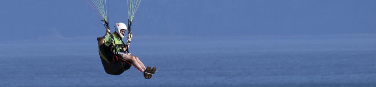
| Suitable for Paragliding: | Yes |
| Regulating Body: | HPAAC and formal agreement with land owner. |
| Site Regulation: | HPAC Membership is mandatory. USHPA is not adequate, as required by land owner. |
| HPAC Rating: | Novice |
| Type of Site: | Coastal Cliff |
| Type of Flying: | Cliff/Ridge Soaring |
| XC Potential: | N/A |
| Description of Site: | 1 km long (primarily straight line) section of coastal cliffs along western end of Orwell Cove. |
| Direction of Launch: | West |
| Launch Elevation: | 60′ asl, Cliff |
| Launch GPS Location: | N 46.115787 W -62.884764 |
| Launch Description: | Launch is large enough to set up only one wing at a time. It has an excellent slope. Do not walk through farmer’s crop. Go around field perimeter to launch. Launch is short –maintained natural grass with some roughness to ground. |
| Launch Site Rating: | Novice |
| Transportation: | Directions to Launch: Drive East of Charlottetown on the Trans-Canada Hwy/PE-1 E (signs forTrans Canada Highway/Prince Edward Island 1 E/Wood Islands) 29.6 km Turn right onto Brush Wharf Rd 750 m Turn left onto New Cove Rd 1.8 km Follow the New Cove Road to the point where it turns into a dirt road. Turn right. Follow this subdivision road to the end and turn left to the end of the road. Road ends in a Cul-de-Sac, park here. Walk to the South East corner of the property toward the shore ensuring to stay on the perimeter of the field if in crop. Driving time: New Cove Rd from Charlottetown = +/-29 minutes Good 2WD road access to end of Cul-de-Sac to top of field in crop. Walk 50m to Launch. |
| Specific Hazards: | |
| Tips and Hints: | All day. West facing sites are best from noon to sunset. During most of the year it is advised to fly when the tide permits beach landing as an alternate LZ. For tide and coastal wind information consult: http://www.windfinder.com/weatherforecast/point_prim Point Prim, Canada |
| Landing Zone Elevation: | Top land at launch or beach landing |
| Landing Zone GPS: | N46.125544 W-62.886610 |
| LZ Description: | Top land at launch, Beach (at low tide), Salt Marsh |
| LZ Site Rating: | Novice |
| Transportation: | Alternate LZ is located approx. 500m north of launch at the salt marsh (see top of this photo) OR land on the narrow beach (present at low tide only). |
| Specific Hazards: | Large Farm Field. Has high crops at some times of the year. Do not land here. Do not land behind trees. Trees at the edge of the cliff can create significant mechanical turbulence and rotor. At the end of day, as the seabreeze diminishes, conditions can change rapidly. Turbulences become less of a factor in top landing but you may only get one chance making a beach landing mandatory. Sandstone cliffs may not be stable. Care must be taken near edge of cliff – falling hazard. |
| Tips and Hints: | |
| Site Fee: | |
| Local Contact 1: | Chris Jette 902-675-3421 Cell: 902-940-0357 chris@a360.ca |
| Local Contact 2: | Brendon McKenna 902-892-0050 Cell:902-314-5125 |
| Seasonal Flying Potential: None (0), Rare (1), Low (2), Good (3), Excellent (4) | |
| Spring: | 3 |
| Summer: | 4 |
| Fall: | 4 |
| Winter: | 1 |
| Recommended Ratings | |
| Mild Conditions: | Novice |
| Moderate Conditions: | Novice |
| Strong Conditions: | Intermediate |
| Special Skills Required: | Need to have strong launching and Top-landing skills at >25 kph winds at launch. Even a slight cross-wind at launch can dramatically affect lift. And always double check for sticks in your lines. Rapidly changing conditions are possible/not uncommon – ATTENTION is required! |
| Other Notes: | There are no airspace restrictions for this site if altitude gain remains below 700 FT AGL. Environment Canada recorded weather service for hourly local conditions: 902-566-7041 |
| Radio Frequency: | HPAAC: 173.640 Mhz |
| Reviewed: | April 23, 2017 |
Skip to content
Hang Gliding and Paragliding Association of Atlantic Canada